3. Geotechnical
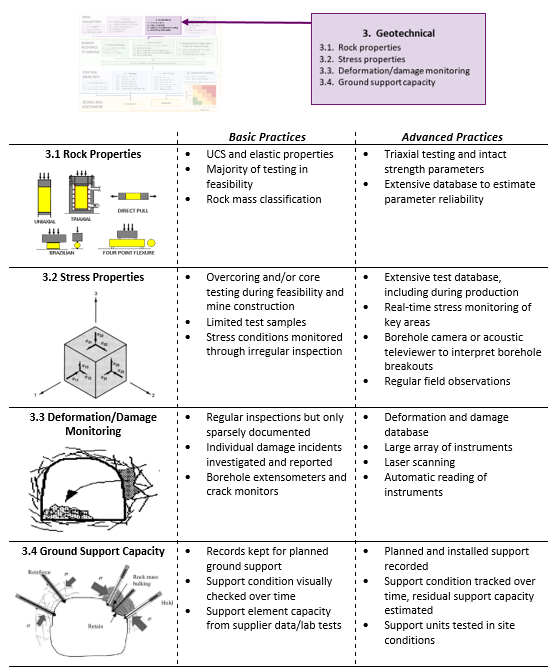
Every operation collects a wide range of different types of geotechnical data. Sites with better practices are continuously reviewing the data quality to ensure the analysis and design assumptions are valid. Better geotechnical data systems are also very well organised and can be easily analysed in a variety of software packages. Four geotechnical data categories are considered; rock properties, stress properties, deformation/damage monitoring and ground support capacity.
3.1 Rock properties
3.1.1 Rock properties – basic
Basic geomechanical properties of intact rock (Uniaxial Compressive Strength (UCS), density (ρ), Young’s modulus (E), Poisson’s ratio (ν)) are generally defined for each geotechnical rock type . Field measurements such as point load tests are often used to supplement laboratory testing. Rock testing is often done during feasibility studies, but additional testing is not conducted regularly during production.
Core logging is normally done using various rock mass classification systems. Borehole mapping using televiewer and underground mapping is often used to supplement core logging data (Figure 9). Rock mass classification systems are generally used to quantify the reduction in strength between the intact rock and the rock mass. The rock mass properties, as an equivalent continuum, are generally used in mine scale numerical modelling assessments. Rock mass quality block models are normally done with the geological modelling software used on site. This sometimes means the format is difficult to export into seismic analysis software which inhibits the assessment of the variation in seismic hazard as a function of rock mass quality.


