Data Collection: Difference between revisions
No edit summary |
No edit summary |
||
| Line 4: | Line 4: | ||
[[1. Data collection – geological]] | |||
<p style="margin-left: 40px;">1.1.1 Structural model – basic</p> | <p style="margin-left: 40px;">[[1.1.1 Structural model – basic]]</p> | ||
<p style="margin-left: 40px;">1.1.2 Structural model – advanced</p> | <p style="margin-left: 40px;">[[1.1.2 Structural model – advanced]]</p> | ||
<p style="margin-left: 40px;">1.2.1 Lithology domains – basic</p> | <p style="margin-left: 40px;">[[1.2.1 Lithology domains – basic]]</p> | ||
<p style="margin-left: 40px;">1.2.2 Lithology domains – advanced</p> | <p style="margin-left: 40px;">[[1.2.2 Lithology domains – advanced]]</p> | ||
[[File:1.00 Data Collection.jpg]] | [[File:1.00 Data Collection.jpg]] | ||
Revision as of 13:00, 1 May 2018
Data Collection
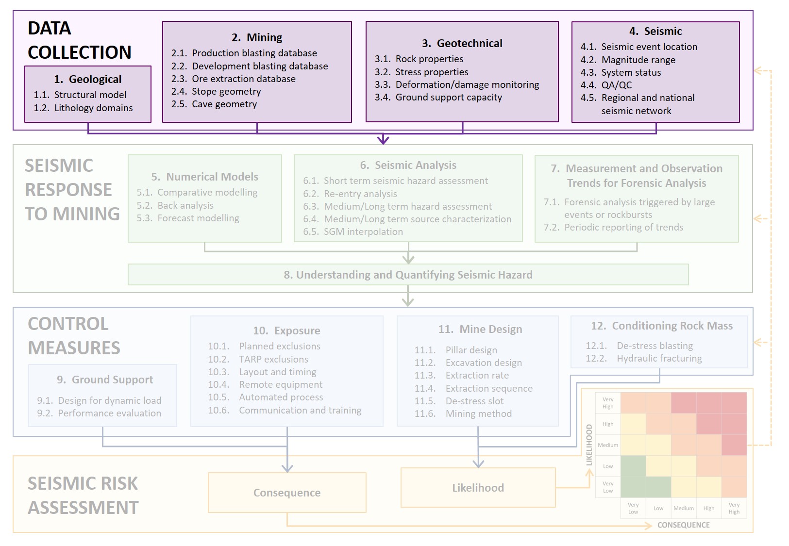
The purple area (Figure 2) of activities in the flowchart indicates the critical data required for seismic risk management. With the exception of seismic data, all other data is generally available in some form at most mine sites. The advanced practice in data collection will have a wide range of data, properly organised in databases with good visualisation, facilitating easy access and regular uses in multiple analyses across all databases.
1. Data collection – geological
1.1.1 Structural model – basic
1.1.2 Structural model – advanced
1.2.1 Lithology domains – basic
1.2.2 Lithology domains – advanced
 Figure2 Flowchart of the seismic risk management process emphasising the data collection activities
Gap # 1
|
GAP #1; Seismic monitoring: Mines are limited in terms of the number of seismic monitoring sensors they can install due to cost, access and data generated by each sensor. Ideally, a very dense array of sensors would enable greater data precision and open new and improved techniques to manage seismic risks. How to fil the gap: New development in hardware and automation of seismic data processing. |

